
Facebook Twitter Flickr YouTube RSS Feed
Written on: July 24th, 2013 in Archaeology Updates, US301
Alternative Mitigation of the Polk Tenant Site (7NC-F-111)
Versar continues to collect information on previously excavated wells from all over the state of Delaware. Last month we reviewed more than 100 archaeology reports prepared for DelDOT over the last 30 years. That review found that at least 50 wells have been identified across the state as a result of archaeological research conducted in advance of highway improvements. Wells have been found on historical home sites, farmsteads, dairy farms, stores, and blacksmith shops dating from the mid-1600’s through mid-1900s. Materials used in the construction of these wells included wood timbers, barrels, stone, and brick. The wells consist of both square and round shafts, with round being the most common form. This month we will visit the Archives of the Division of Historical and Cultural Affairs in Dover. There Versar researchers will review reports from non-DelDOT sponsored archaeological investigations. We plan to examine reports conducted by other state agencies, federal agencies and the military, universities, or by volunteer community groups such as the Archaeological Society of Delaware.
To learn more about this site, visit: https://deldot.gov/environmental/archaeology/williams/index.shtml
Written on: July 11th, 2013 in I-95, I95/SR1 Interchange
The northbound I-95 to northbound Route-7 ramp was opened in May 2013.
Structural steel beams for the bridges was delivered throughout the spring and is all in place. Construction continues on the rest of the bridges, decks, overpasses, roadway paving, and retaining walls.
The project is about 80 % completed.
The northbound Route-1 to northbound I-95 flyover ramps and the southbound I-95 to southbound Route-1 flyover ramps will be opened during the Fall.
Written on: July 3rd, 2013 in Route 26
DelDOT’s self-imposed July 1 deadline for lane closures along SR26 has come and gone, and as planned utility companies have completed their scheduled work on time. This means that as of July 1, 2013 lane closures will no longer be required for overhead utility relocation work along Route 26. Overhead utility relocation work will continue through the summer, but without the need for lane closures. Delmarva Power and Verizon will continue to work on underground services, street light installation, moving facilities from old poles to new poles, and old pole removal. Thanks to the hard work of Delmarva Power, Verizon, Mediacom, and their sub-contractors, nearly half of the project’s utility relocation effort has been completed! DelDOT would like to congratulate Delmarva Power, Verizon, Mediacom and their sub-contractors on reaching this important milestone in the SR26 project. DelDOT would also like to thank the traveling public along Route 26 for their patience and understanding during this difficult operation.
Written on: July 1st, 2013 in Archaeology Updates, US301
Here is the location of the Polk Tenant Site on the 1868 Beers Atlas Map.

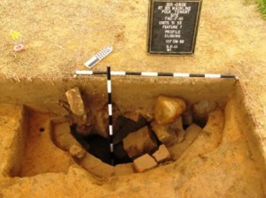
And a photograph of a partially excavated well at the Polk Tenant Site.

Written on: July 1st, 2013 in Archaeology Updates, US301
Update on the Dale African American archaeological site:
Samuel Dale’s Strange “Manumission,” 1854
The Samuel Dale who owned the Dale Site lived as a free man for most of his life. Born in 1791, he first appeared in the census as a free man in 1810. He was counted as a free man every ten years thereafter, all the way to 1870, shortly before his death. We were therefore shocked to find in the New Castle County deed book for 1854 an entry reading,
Know all men by these presents that I Nicholas Patterson of the City of Wilmington New Castle County and State of Delaware (Minister of the Gospel) from motives of benevolence and humanity, have manumitted and do manumit and set free from slavery my negro man Samuel Dale of St. Georges Hundred in the County and State aforesaid aged about forty years, he the said Samuel Dale having been the slave of James Haughey late of St. Georges Hundred decd who by his will gave the said Samuel Dale (among other things) to his children and the survivor of them, the only survivor of whom is Mrs. Eliza Patterson, formerly Eliza Haughey and now wife of the said Nicholas Patterson.
At first we thought that this must be some other Samuel Dale. After all, this document says Dale was about forty, and the owner of the Dale Site would have been about 65. So far as we can tell, though, the only other Samuel Dale living in St. Georges Hundred was the son of our Samuel Dale, who was younger than forty in 1854 and just as free as his father. We also know that our Samuel Dale was connected to the Haughey family, and that the land Dale bought once belonged to the Haugheys. Besides, until recently many older people had only a vague notion of their own ages. So the manumission must have been for the owner of the Dale Site.
But why was a manumission enrolled in 1854 for a 65-year-old man who had been living free for at least 44 years? Probably because of the other major event in Dale’s life that year, his purchase of the 20 acres of land that became his farm. Either when he proposed to buy the land, or when he tried to have the deed enrolled at the court house, somebody must have demanded proof that Dale was in fact a free man. If there ever was a written record of Dale’s manumission 44 years before, it had been lost. So Dale had to track down the only surviving daughter of his former master and persuade her husband to free him again, this time with proper documentation. Just one small sign of the difficulties faced by African Americans in the nineteenth century.

Written on: June 27th, 2013 in Archaeology Updates, US301
Versar, Inc. has begun the work of writing up the Polk Tenant Site (7NC-F-111) identified in 2009 and then carefully excavated by the archaeologists at Richard Grubb and Associates. The site includes the archaeological remains of a tenant or farm worker’s house that may have been part of the nearby C. Polk Estate. It is located along the present path of US Route 301 west of Middletown near the Delaware/Maryland state line. We know from archival research that the site was part of a farm run by members of the Evertson, Cyrus Polk, and William Taylor families during the 19th and 20th centuries. Important features found by archaeologists at the site include a cellar, brick foundations, and a brick-lined well.
In addition to writing up the site archaeology, Versar will be conducting a special study on wells in Delaware. Several of the sites along the Route 301 corridor had very well preserved wells, and while wells have been excavated at many sites across the state, there is still a lot we don’t know about these important features. Creating a synthesis of this feature type from across the state will provide an opportunity to expand what we know about how wells were built and used.
To do this, over the course of the next year or so, Versar archaeologists and historians will gather information on previously excavated wells from all over Delaware. Some of the information to be collected will include the shape of wells that have been found, the methods and materials used to construct them, and where the wells occur relative to houses, barns or other structures. We will also examine the methods archaeologists use to excavate wells. We will summarize what is known about wells in Delaware and create a research tool that other archaeologists will be able to use to see how wells they find compare to what has been found before. Our work began this month with a review of archaeological reports written for DelDOT. So far, we have found more than 50 wells that we will be including in our study.
Written on: June 13th, 2013 in Route 26
In an effort to balance impacts to the traveling public and local businesses with the need to facilitate ongoing overhead utility relocations, DelDOT has modified the hours during which lanes can be closed on SR26. For the rest of the month of June 2013, lane closures will be restricted to the following hours:
Monday – Thursday: 5am to dusk.
Friday: 5am to noon.
No lane closures will be allowed from noon, Friday through Monday morning.
These hours will remain in effect through June 30, 2013. From July 1, 2013 to September 30, 2013 lane closures will be restricted to the hours between 7 p.m. and 6 a.m., Monday through Friday morning. Lane closures will not be allowed on Holidays and Weekends during this period. DelDOT will monitor the impacts of lane closures both with local forces, and stationary and mobile cameras. DelDOT maintains the rights to modify the time restrictions based off of delays.
Written on: June 6th, 2013 in Route 26
In an effort to facilitate ongoing overhead utility relocations, DelDOT has modified the restrictions on lane closures during the peak season for SR26. The peak season began May 15 and ends September 30. Lane closures during the peak season would normally be restricted to the hours between 9 a.m. and 3 p.m., Monday through Friday.
DelDOT has modified the hours during which lanes can be closed on SR26. For the rest of the month of June 2013, lane closures will be restricted to the following hours:
These hours will remain in effect through June 30, 2013. From July 1, 2013 to September 30, 2013 lane closures will be restricted to the hours between 7 p.m. and 6 a.m., Monday through Friday morning. Lane closures will not be allowed on Holidays and Weekends during this period. DelDOT will monitor the impacts of lane closures both with local forces, and stationary and mobile cameras. DelDOT maintains the rights to modify the time restrictions based off of delays.
Written on: May 29th, 2013 in Archaeology Updates, US301
Watch as Michael Carmody, Archaeologist, from Dovetail Cultural Resource Group gives a final update on the excavations at the Warwick Native American Archaeology site.
Written on: May 21st, 2013 in Archaeology Updates, US301

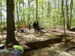
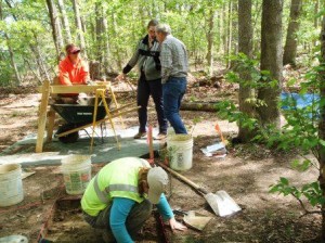
On May 3, representatives from the Maryland Historic Trust (MHT), the Federal Highway Administration (FHWA) and the Delaware Department of Transportation (DelDOT) visited the Warwick Site. Planned improvements to Route 301 led to the excavation of the site, and, in turn, to coordination with various state and federal agencies. Near the Warwick Site, Route 301 narrows from a two-lane road in Maryland to one lane in Delaware; therefore, DelDOT’s road widening will extend a short distance into Maryland to avoid creating a bottleneck near the state line. Coordination with both states was required to ensure the work meets the requirements of both state agencies, as well as the FHWA. Since excavation destroys the archaeological record at the same time information is collected, meeting with representatives on site allowed the participants to examine the ongoing work directly rather than filtered through Dovetail’s documentation and interpretation.
At the meeting, DelDOT, thanked everyone for coming and turned the meeting over to Dovetail Cultural Resource Group (Dovetail) for an overview of the site. Mike Carmody of Dovetail presented an overview of the excavation strategy, and discussed public outreach. Mike Klein, Dovetail archaeologist, then described the specific results of the excavation, including an overview of the vertical and horizontal distribution of artifacts, the type of artifacts recovered, and the approach to excavation. Conversation with the agency representatives clarified aspects of the excavation and the ongoing research and analysis. The meeting concluded with FHWA and MHT staff engaging the Dovetail field crew, who continued the fieldwork throughout the meeting.
