Facebook Twitter Flickr YouTube RSS Feed

US Route 301 Archaeology Update
Written on: July 30th, 2012 in Archaeology Updates US301

- Feature Mapping
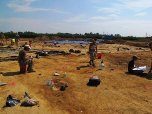
This week at the Rumsey-Polk site, archaeologists continued to measure, map, describe, draw and photograph the site’s cellar holes, pits, posts, wooden sills, and remains of former structures made and used by the 18th and 19th-century tenant farmers (photo). Over 240 of these “features” were meticulously and carefully documented to enable archaeologists to understand what these features are, when they were made, and what we can learn from them. This documentation and mapping must be done before we can dig the best features. We also had a visit by DelDOT representatives.
DelDOT Representatives

