
Facebook Twitter Flickr YouTube RSS Feed

Written on: August 31st, 2012 in Archaeology Updates, US301

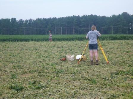
This was a big week at the Bird-Houston Site, when we stripped off the plowzone to see what lies beneath. After two long days of following the excavator across the site, we exposed dozens of pits, post holes, and other “features.” This is exhausting work, shoveling up loose soil and trowelling off soil stains while standing amidst the noise, heat, and diesel fumes. It is also rewarding, because we find more and see more in one day than in weeks of hand digging. Now we will turn to making a map of all these new discoveries, and then to excavating them by hand.
Written on: August 31st, 2012 in Archaeology Updates, US301
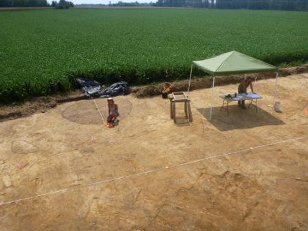
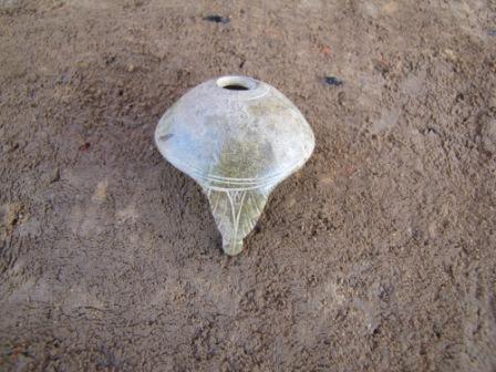
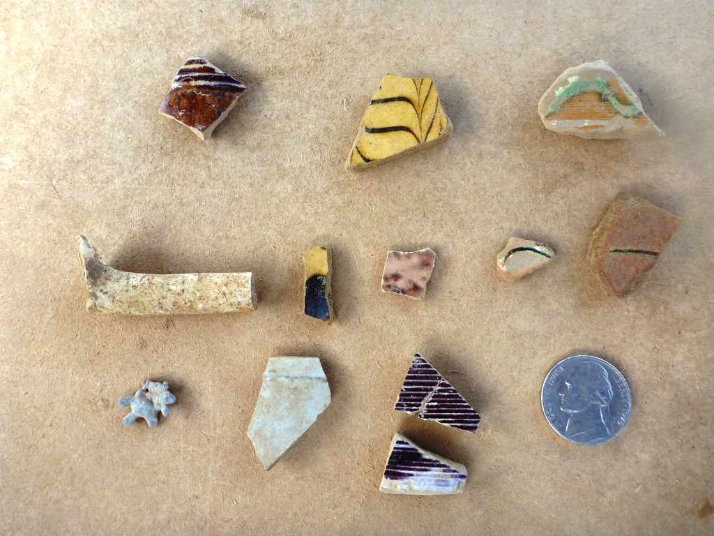
This week at the Cardon-Holton Site Hunter Research, Inc. was busy removing the plowzone revealing numerous features dating to the early 18th century and possibly the late 17th century. Along the site’s southern border a large circular stain measuring 11 feet across was exposed. An auger test placed in the center suggested it extended four feet below the bottom of the plowzone with fresh water currently at six feet below the base of the plowzone. At first we thought it might be a shallow well but initial exploration revealed a void where wood once lined the upper two feet suggesting the shaft may have served as a cistern or an icehouse. Further excavations should give us more clues as to the true function. Artifacts from the initial excavation include a small eight-sided silver button with an inscribed flower, a few wrought nails and ceramics dating to the first half of the 18th century such as English made ceramics (Midlands mottled, buff-bodied Staffordshire ware, Jackfield ware, and black matt glazed red-bodied earthenware) and German Westerwald stoneware. Mechanical stripping of the plowzone exposed several features originally identified in the initial testing. Small bits of North Devon sgraffito plates recovered from the plowzone lead to the discovery of the two large mending sherds pictured below recovered from the top of a probable refuse pit. Larger sherds like these may help us identify the area in Devon from which they were made.
Written on: August 29th, 2012 in Archaeology Updates, US301
While large features like the Houston-LeCompt cellar offer a great deal of information on the buildings that once stood on the site, some small features can highlight the daily activities of its occupants. In this video, Dovetail Lab Manager Kerry Gonzalez discusses a small roasting pit once used to prepare food. She also helps to answer a question archaeologists get asked every day: what happens to all of the artifacts once they leave the field?
Written on: August 28th, 2012 in Archaeology Updates, US301
One of the largest and most complex features identified at the Houston-LeCompt site is a cellar, which appeared under the plowzone as a dark, rectangular soil stain with an abundance of stone and brick. Watch as Dovetail archaeologist Johnie Sanders talks about the ongoing excavation of this exciting feature.
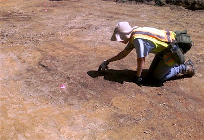
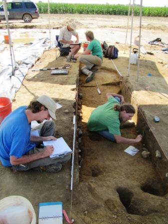
Written on: August 28th, 2012 in Archaeology Updates, US301
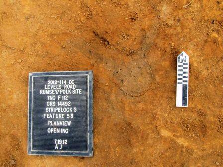
The archaeological fieldwork at the Rumsey/Polk Tenant/Prehistoric site is nearing an end, and we sure do have a lot of data from the site. Two overlapping historic occupations (one mid- to late 18th and one early to mid-19th century in date) have left a cascade of over 600 cultural features. Nearly one hundred have been excavated in full or part. Roughly 5/6th of the features are stains left by post holes and decayed posts. Others are crawl spaces and sub-floor cold storage pits below former buildings, refuse or trash pits, possible privies, and one well. The majority of these larger features have been archaeologically sampled and produced a rich diversity of cultural material from both historic occupations. Many of the post stains show us the locations of former fence lines that once criss-crossed the site, separating house yards from farm fields, barns, and animal pens, or living areas from work areas. In addition to fence lines, several posts indicate the locations of earthfast buildings. Such structures lacked masonry foundations, and were instead supported by hole-set posts, wooden sills, and wooden piers. This building method was common in the Middle Atlantic Region during the 17th century. By the early 18th century and into the early nineteenth-century, earthfast architecture was used in conjunction with masonry building techniques. Studies in New Jersey and Delaware indicate that by the third-quarter of the 18th century, fewer homes were built using earthfast construction techniques, but the construction of earthfast out buildings, including barns, animal sheds, out kitchens, corn cribs, and hay barracks continued into the 19th century. The absence of intact masonry foundations at the Rumsey/Polk Tenant/Prehistoric site suggests all of the buildings on site were of earthfast construction and/or, if buildings with stone or brick masonry foundations were constructed, masonry foundations did not extend below the topsoil and the usable stone or brick was removed for reuse elsewhere. Observation of post patterns based on our field maps suggest several buildings were present on the site with floor plan dimensions ranging from 16’x18’, 12’x24’, 16.5’x19.5’, and 9’x16.5’. These buildings appear to have been oriented along a northwest/southeast axis to provide maximum solar exposure and likely represent a variety of building types, including dwellings, out kitchens, sheds, and barns. The excavation of sub-floor pits that would have been below many of the buildings will aid in determining their age and use .
 Archaeologists Jonathan Lewis, John Potts, Kevin Enlow, and Brian Manser excavating a large 19th-century cold cellar beneath a possible earthfast house
Written on: August 28th, 2012 in Archaeology Updates, US301
We’re under way at the Bird-Houston Site. This corner of a flat, muddy field was somebody’s home for 150 years, from around 1770 to 1920. The house here appears on no map and was never noticed by the tax collector. Even on surveys of the property the spot is just mapped as a wood lot. The residents were tenants, and their hidden little house in the woods must have been dear to their hearts. Please see this link to learn more about the site:
https://deldot.gov/environmental/archaeology/us301/pdf/handouts/BirdHoustonSiteHandout.pdf
During the testing of the site last year we found that it is divided into two parts. One part dates to around 1770 to 1830, the other from 1830 to 1920. Likely the first house on the site was falling down, so the residents built a new one 50 yards away. We found interesting things in both parts. In the more modern part we found a well, filled in when the site was abandoned, and what we think are house foundations. On the older part we found some pits, some post holes, and a weird pit, half filled in with clay from the swamp nearby, which nobody has been able to interpret. Maybe we’ll figure it out when we dig the rest! Next week we’ll bring out a backhoe and start stripping the topsoil from the site, we can’t wait to see what we will find.

Written on: August 21st, 2012 in Elkton Road
Effective Monday, August 20, the “No Right Turn on Red” from Casho Mill Road onto Elkton Road restriction has been removed. Drivers will now be permitted to turn right on red following a complete stop and ensuring the road is clear.
Written on: August 20th, 2012 in Archaeology Updates, US301
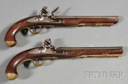
This week a number of personal items were found that tell us about the individuals who lived at the Rumsey/Polk Tenant/Prehistoric site. Most notably, thanks to the sharp eyes of archaeologist and crew member Neal Sexton, a decorated domed brass artifact was identified as the butt cap to an 18th or early 19th-century flintlock pistol handle. Hand engraved, the brass cap was part of a pistol believed to have been American-made and used by an officer in the Continental Army or a member of a militia during the American Revolution. A pewter “USA” button worn by Continental Army soldiers, was found at the site, and was previously featured in a blog entry https://blogs.deldot.gov/2012/07/17/us-route-301-archaeology-update-9/), and further suggests one of the site occupants was a member of the Continental Army. Military objects could also have been owned by a member of the local Bohemia Battalion Mititia commanded by William Rumsey Jr., who was the owner of the site property at that time. Other firearms material has been found at the site, such as French and English gunflints and a canon-style barrel of a flintlock pocket pistol displayed on our public flyer https://deldot.gov/environmental/archaeology/brochures/rumsey_polk/RumseyPolkFlyer.pdf
Additional artifacts found this week include an assortment of plain and decorated pewter and copper alloy coat and vest buttons; a fancy, decorative button with a glass faux gem; and pins used to secure clothing and paper (pins were used prior to the invention of wire paper clips). During the 18th and early 19th century, men’s clothing contained an abundance of functional and decorative buttons, some of which we found littered across the site. Objects like those featured in this week’s blog help us form a picture of the style of dress used by the occupants, and firearms used in defense.
Written on: August 20th, 2012 in Archaeology Updates, US301
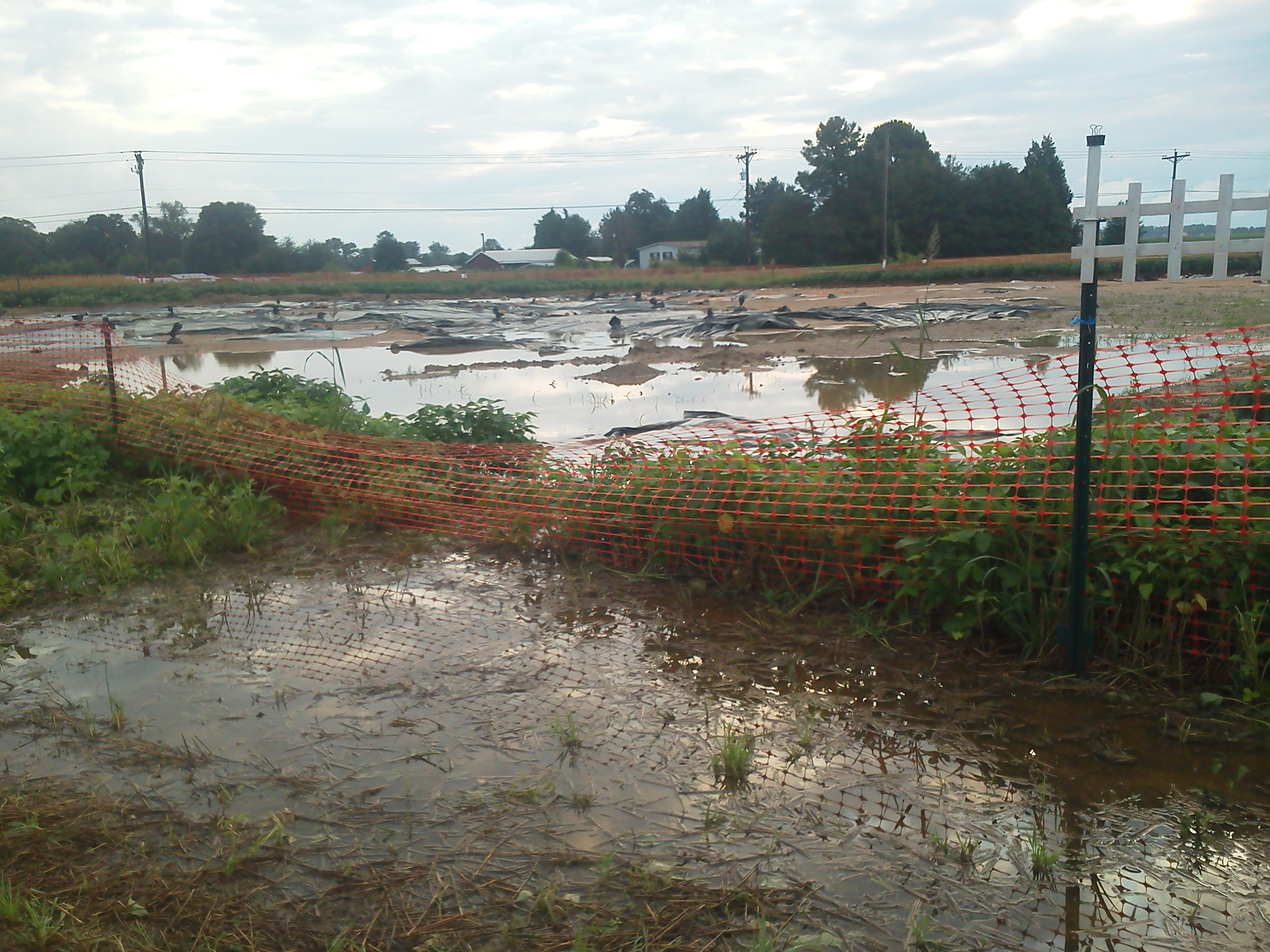
The Houston-LeCompt Site has had its share of complications as fieldwork has gone on. Saturday we arrived to find the site largely underwater due to torrential rains in the Middletown area. It was a long day of bucket bailing, shopping for a sump pump capable of removing that much water, putting up with wet clothes, and sloshing in wet boots. All of that fun archaeology stuff that never seems to make it into a History Channel documentary or Indiana Jones movie. The nature of working on a site that has been stripped of topsoil also means that rains generate a sheet wash along the surface that carries fine silt and clay particles with it, that always seems to find its way to the exact features we were working on before the rain. This sheet wash covers the exposed features with a layer of slimy red dirt that leaves us starting the feature clean up process all over again. Despite that, we have managed to move a lot of dirt, and are making our way through feature excavation. We are exposing more of the brick cellar walls, and getting deep down into well shafts. We also encountered a possible roasting pit with lots of charcoal and animal bone.
By Sunday we had the site partially drained, and dried out enough for an army of volunteers and observers. Over a dozen volunteers plus family members came out as we opened up the site, not only for serious archaeology work, but also as an interpretive site and community activity center. Kids young and old had a blast combing the back dirt piles for artifacts. Area residents who had been passing by the site for weeks got a chance to shovel dirt out of the piles, screen for artifacts, and wash them. A lady who had read about the site in the paper came to the site with her “LeCompte” family tree and coat of arms, which we photographed to see if historic research shows a connection between the previous owner James LeCompt and her family. What a difference a day makes when you have a good crew. Everyone on the Dovetail team did a great job of getting the public involved and going with the flow. Our thanks to the crew, and thanks to the great folks of the surrounding community!
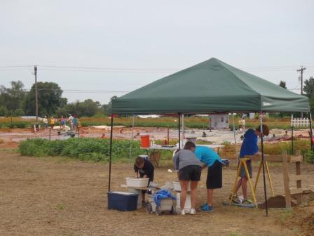
The Houston LeCompt site this past Sunday
Written on: August 20th, 2012 in Archaeology Updates, US301
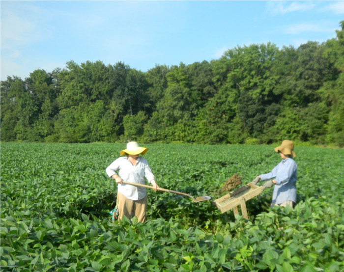
Last week Hunter Research, Inc. started data recovery excavations at the Cardon-Holton Site (7NC-F-128, N14508), another early historic farmstead along the U.S. Route 301 alignment. (Below is a link to a handout about the site.)
https://deldot.gov/environmental/archaeology/us301/pdf/handouts/CardonOnePageHandout.pdf
Historic research into this property indicated that from 1685 to 1722 this area was part of an extensive plantation called “Riley’s Industry”, after which the property was owned by William Cardon from 1722 to 1760. The site lies near the perimeter of the Black Marsh and close to the path of an unnamed branch of Augustine Herrman’s cart road, which was laid out around 1660. This road was used for both legal and illicit trade between the Chesapeake and Delaware Bays. The Cardon-Holton site now lies hidden beneath a lush crop of soybeans. Prior to excavations, the crop had to be removed from the identified core of the site as well as from areas for stockpiling soils, for an access road into the site, and a parking area. Once the crop was removed, the center-line of U.S. 301 was shot in by surveyors from Century Engineering and the locations of excavation units from earlier phases of work were re-established.
Initially six, six-foot square excavation units were targeted to recover artifacts from the plow-zone in areas where concentrations were observed on the surface and subsurface during the earlier excavations. Numerous important artifacts dating to the late 17th and early 18thcenturies recovered from these first excavation units led us to increase the number to 16. At the same time the backhoe was busy stripping off the plow-zone from the northern portion of the site. Equipped with a sharp, flat steel collar, the machine leaves a crisp clean surface which is then refined with a flat-bladed shovel and trowels to reveal disturbances to the underlying subsoil, both cultural (such as pits and post holes) and non-cultural (such as trees and animal burrows).
Delaware's Governor
State Agencies
Elected Officials
General Assembly
Delaware Courts
State Employees
Cities & Towns
Delaware State Code
State Regulations
Business First Steps
Phone Directory
Locations Directory
Public Meetings
Voting & Elections
Transparency
Delaware Marketplace
Tax Center
Personal Income Tax
Privacy Policy
Weather & Travel
Contact Us
Corporations
Franchise Tax
Gross Receipts Tax
Withholding Tax
Delaware Topics
Help Center
Mobile Apps
E-mail / Text Alerts
Social Media

Built by the Government Information Center
©MMXVIII Delaware.gov

